Arraiján District (Distrito Arraiján)
Arraiján is the district (distrito) of West Panamá Province in Panama. The territory lies west of the Panama Canal bordering Panama City. The population according to the 2000 census was 149,918; the latest official estimate (for 2019) is 296,188, with many suburban communities for commuting workers of Panama City. The district covers a total area of 418 km². The district seat is Arraiján city.
Arraiján District is divided administratively into the following corregimientos:
* Arraiján (capital)
* Juan Demóstenes Arosemena
* Nuevo Emperador
* Santa Clara
* Veracruz
* Vista Alegre
* Burunga
* Cerro Silvestre
Arraiján District is divided administratively into the following corregimientos:
* Arraiján (capital)
* Juan Demóstenes Arosemena
* Nuevo Emperador
* Santa Clara
* Veracruz
* Vista Alegre
* Burunga
* Cerro Silvestre
Map - Arraiján District (Distrito Arraiján)
Map


Country - Panama
 |
 |
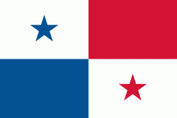
| Flag of Panama | |
Panama was inhabited by indigenous tribes before Spanish colonists arrived in the 16th century. It broke away from Spain in 1821 and joined the Republic of Gran Colombia, a union of Nueva Granada, Ecuador, and Venezuela. After Gran Colombia dissolved in 1831, Panama and Nueva Granada eventually became the Republic of Colombia. With the backing of the United States, Panama seceded from Colombia in 1903, allowing the construction of the Panama Canal to be completed by the United States Army Corps of Engineers between 1904 and 1914. The 1977 Torrijos–Carter Treaties agreed to transfer the canal from the United States to Panama on December 31, 1999. The surrounding territory was first returned in 1979.
Currency / Language
| ISO | Currency | Symbol | Significant figures |
|---|---|---|---|
| PAB | Panamanian balboa | B/ | 2 |
| USD | United States dollar | $ | 2 |
| ISO | Language |
|---|---|
| EN | English language |
| ES | Spanish language |